Unearthing the Past From Above: The Revolutionary Role of Satellites in Archaeology
- Jan 17
- 3 min read
Archaeology has long been a field of painstaking excavation, dust-covered digs, and slow discoveries. But what if the secrets of ancient civilizations could be uncovered without turning a single spade of earth? Thanks to satellites orbiting high above the planet, this is no longer a dream. Satellites equipped with advanced infrared technology are revealing thousands of hidden pyramids and structures buried beneath deserts and dense jungles. This new era of archaeology is transforming how we explore the past, offering a futuristic and adventurous glimpse into lost worlds.
How Satellites See What the Eye Cannot
Traditional archaeology relies on visible clues: ruins, artifacts, or inscriptions exposed on the surface. But many ancient sites remain invisible, hidden under layers of sand, soil, or thick vegetation. Satellites equipped with infrared sensors detect heat differences and subtle variations in the earth’s surface. These differences can reveal the outlines of buried walls, chambers, and other man-made structures.
Infrared technology works by capturing wavelengths of light beyond what the human eye can see. When sunlight heats the ground, buried structures affect how heat is absorbed and released. For example, stone walls retain heat differently than sand or soil. Satellites detect these temperature contrasts, creating detailed maps of what lies beneath.
This method allows archaeologists to scan vast and remote areas quickly and non-invasively. Instead of digging blindly, they can target specific locations with a high chance of discovery. This approach saves time, money, and preserves fragile sites from unnecessary disturbance.
Sarah Parcak and the New Age of Space Archaeology
One of the pioneers of satellite archaeology is Sarah Parcak, an Egyptian-American archaeologist who has changed how we explore ancient Egypt and beyond. Parcak’s work uses satellite imagery to identify potential archaeological sites without digging a single inch.
Her approach combines infrared data with other satellite technologies, such as radar and multispectral imaging. This combination enhances the ability to detect buried structures under sand dunes or dense jungle canopies. Parcak’s team has identified thousands of previously unknown sites, including pyramids, tombs, and ancient settlements.
In 2016, Parcak won the TED Prize for her groundbreaking work. She called for a global effort to use satellite technology to protect and explore archaeological sites worldwide. Her discoveries have already reshaped our understanding of ancient civilizations and opened new frontiers for research.
The Adventure of Discovery From Space
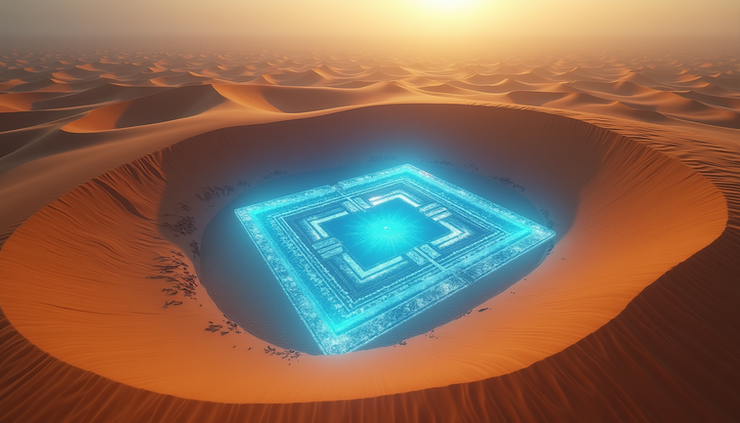
Satellite archaeology feels like a science fiction adventure. Imagine scanning a barren desert from hundreds of miles above Earth and suddenly seeing the perfect geometric shape of a pyramid glowing beneath the sand. This futuristic vision is now reality.
The process begins with satellite data collection, often from government or commercial satellites orbiting Earth. Researchers analyze the images using specialized software that highlights anomalies in the landscape. These anomalies might be straight lines, right angles, or patterns that suggest human construction.
Once a promising site is identified, archaeologists plan targeted expeditions to confirm the findings on the ground. This method reduces guesswork and increases the chances of uncovering significant artifacts or structures.
The ability to explore vast and inaccessible regions remotely also helps protect sites from looting and destruction. Satellite monitoring can alert authorities to illegal digging or damage, preserving cultural heritage for future generations.

Practical Examples of Satellite Archaeology
Egypt’s Lost Pyramids: Parcak’s team identified over 1,000 potential pyramids and thousands of tombs and settlements in Egypt using satellite infrared imaging. Many of these sites were previously unknown and buried beneath shifting sands.
Mayan Cities in Guatemala: Satellites equipped with LiDAR technology have revealed entire ancient Mayan cities hidden under dense jungle canopy. These discoveries have expanded knowledge of Mayan civilization’s scale and complexity.
Mesopotamian Sites: Satellite imagery has helped locate ancient cities in Iraq and Syria, some buried under modern urban areas or desert. This aids in planning excavations and protecting sites from conflict damage.
The Future of Archaeology Is in the Sky
As satellite technology advances, the resolution and capabilities of space-based sensors continue to improve. This progress will allow archaeologists to detect even smaller and more subtle features beneath the earth’s surface.
Artificial intelligence and machine learning are also being integrated to analyze vast amounts of satellite data quickly. These tools can identify patterns and anomalies that human eyes might miss, accelerating discoveries.
The combination of satellite archaeology with traditional fieldwork creates a powerful synergy. It allows researchers to explore the past more efficiently, ethically, and comprehensively than ever before.
For those fascinated by history, technology, and exploration, satellite archaeology offers a thrilling glimpse into the unknown. It invites us to look up at the sky and imagine the stories hidden beneath our feet, waiting to be uncovered by eyes in the sky.


Comments